contact@arkeotopia.org


Translation by N. Johnston and H. Brand
Appreciating archaeological data
In the air with Jacques Dassié on Wikimedia Commons
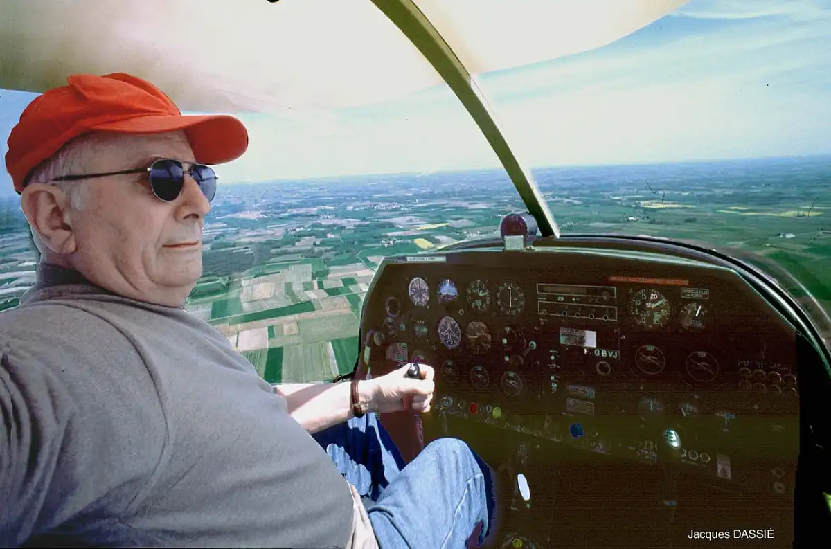
In total, nearly 200 photos were uploaded, about half of which I uploaded myself. Most of the photos are aerial surveys, ongoing excavations, and monuments taken starting in the 70s, mainly in the Charente and Charente-Maritime departments (near Bordeaux). In addition there are a few pictures taken from the ground of ongoing excavations, unearthed artifacts, and structures under construction.The photos cover a large span of time: the oldest sites date back to the Neolithic period.
The Wikimedia Commons digital library, chosen to host Jacques Dassié’s photo archive, is a platform for multimedia file-sharing, mainly photos, where files are under open licenses and available for everyone. Anyone and everyone can make an account and upload images with the goal of making them available for the user community.
After verifying that the pictures were not already on Wikimedia Commons, the major difficulty was describing the uploaded photos as precisely as possible, giving them an appropriate title as well as a caption and brief description. This required research, particularly on Jacques Dassié’s personal website. Depending on the quantity and quality of available information online, this step, prepared before the photo could be uploaded, could take up to one hour per photo.
But how exactly was this work rewarding for me?
I learned about Jacques Dassié and aerial surveys
Before joining ArkéoTopia, I had never heard of Jacques Dassié, one of the pioneers of aerial surveying in France. It was only recently that I learned about him and his enormous contribution to archaeological research in the Poitou-Charentes region, where most of the sites he identified have been excavated.
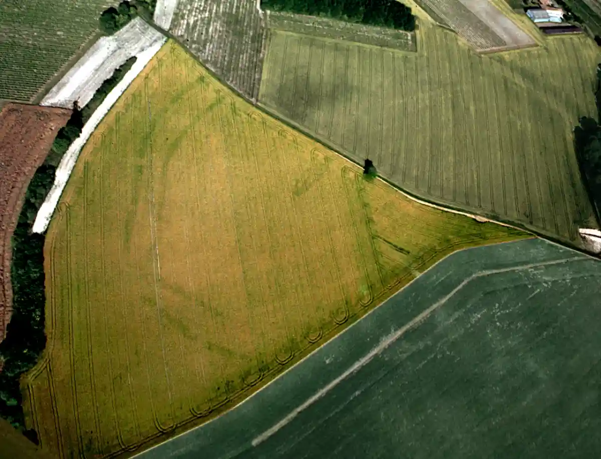
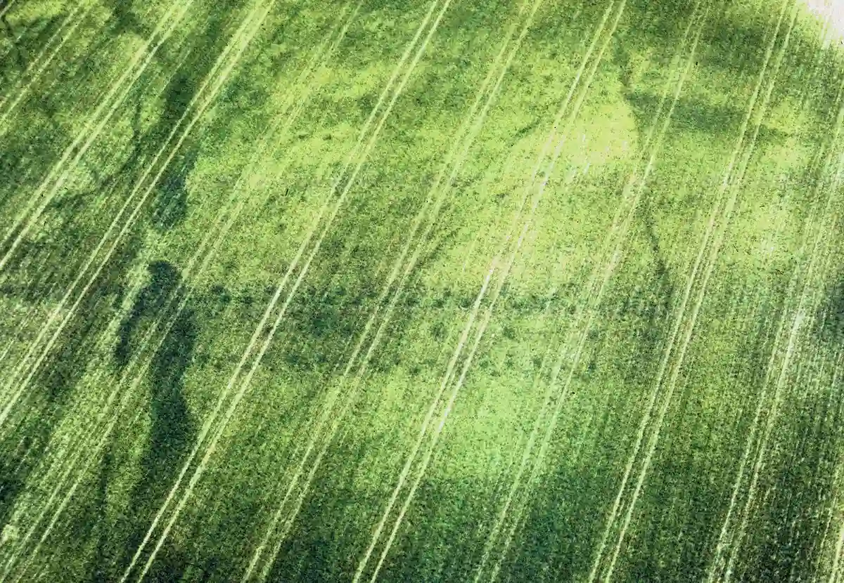
While reviewing Jacques Dassié’s photo archive, I realized how valuable aerial photography is in archaeological surveys. Indeed, under certain conditions of terrain, light, and humidity, the perspective provided by altitude reveals buried archaeological structures organized through traces visible on the ground surface and in the vegetation, whereas only scattered traces are detected during ground surveys. In addition to the method’s inherent value, the many hours of flight time Jacques Dassié has logged during surveys make him a true expert on the region: he knows the optimal conditions and the best locations for identifying archaeological sites.
I learned about the archaeological wealth in the Charente and Charente-Maritime region
The photos taken by Jacques Dassié capture the wealth of archaeological sites in the Charente and Charente-Maritime departments, where the causewayed enclosures from the late Neolithic period, Roman settlement, and fortified strongholds stand out.
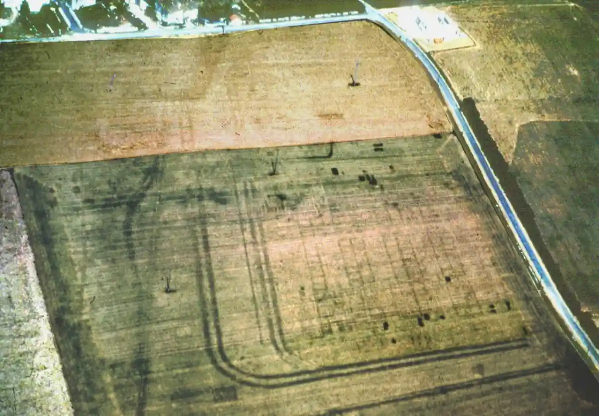
The large Neolithic causewayed enclosures, such as the ones in Coteaux de Coursac in Balzac (Charente), Camp in Challignac (Charente), and Diconche in Saintes (Charente-Maritime), are revealed through aerial survey by their complex sets of pits, inside which we can sometimes piece together the foundations of buildings.
The wide-ranging Gallo-Roman cities, such as the castrum (military base) of Aunedonnacum in Aulnay-de-Saintonge and the port city of Barzan, both of which are in the Charente-Maritime department, include a variety of military structures. Aunedonnacum is known for its soldier barracks and depots, while the Gallo-Roman city of Barzan includes a port, thermal baths, and temples. In these sites, aerial photography shows a jumble of building and street plans.
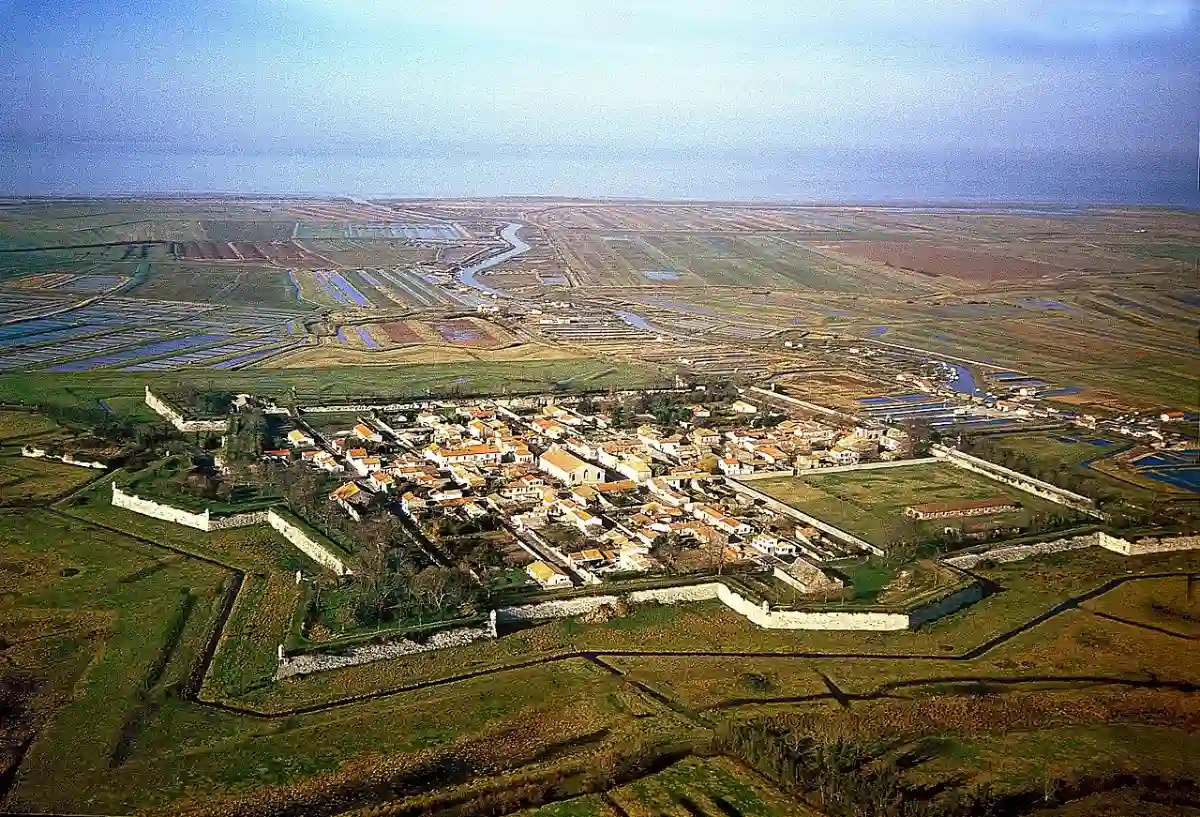
The fortified strongholds in Charente-Maritime, to me, are a true discovery. The fortresses and buildings of the citadel of Brouage (Hiers-Brouage) and the islet of Talmont-sur-Gironde are spectacular when seen from above and bear witness to the region’s appeal during the Middle Ages.
I learned about Wikimedia Commons and its relevance for archaeological research
Thanks to uploading Jacques Dassié’s photo collection online, I realized that Wikimedia Commons is a collaborative database with immense potential for archaeological research and the preservation of cultural heritage.
Next, Wikimedia Commons is an easy-to-use tool, both for uploading images and for finding them. Photographs are placed into categories, which enables you to access an entire corpus of similar images if you are doing research, which can also help with the chronological allocation of a site.
Finally, Wikimedia Commons has a global reach not only because images don’t require knowledge of a certain language, but also because the version history of each uploaded image provides a way for you to find who took it and all the people who have made corrections or changes: a contact network is taking shape. For example, for my own research on prehistoric pile dwellings in Switzerland, for example, I discovered that the category “Les Roseaux/La Grande Cité (Coastal Sites)” contains underwater photographs of remains currently preserved in Lake Geneva. Through the history associated with these images, I now have a way to contact the photographer for further information regarding the location of the remains.
For more information
- Check out Jacques Dassié’s photo archive on Wikimedia Commons, thanks to the work of ArkeoTopia upon Jacques Dassié’s request
- Check out Jacques Dassié’s personal website for more information about aerial surveys
- Read “Specialist despite myself: An interview with Jacques Dassié” to learn more about his work on ArkeoTopia’s website
- Read “Wiki Loves Monuments: a Contest for Archaeology” to learn more about the importance of Wikimedia Commons through the world’s largest photography contest on ArkeoTopia’s website