Lidar technology reveals thousands of Mayan constructions.
- Last Updated: Thursday, 13 May 2021 15:28
- Published: Monday, 22 April 2019 18:29
- Written by Lionel Tabourier translated by Janet Langridge
- Hits: 2343
How does a new, hi-tech, detection system reveal the existence of Mayan buildings and a network of connections between previously unknown cities? The Franco-Guatemalan Naachtun project helps explain.
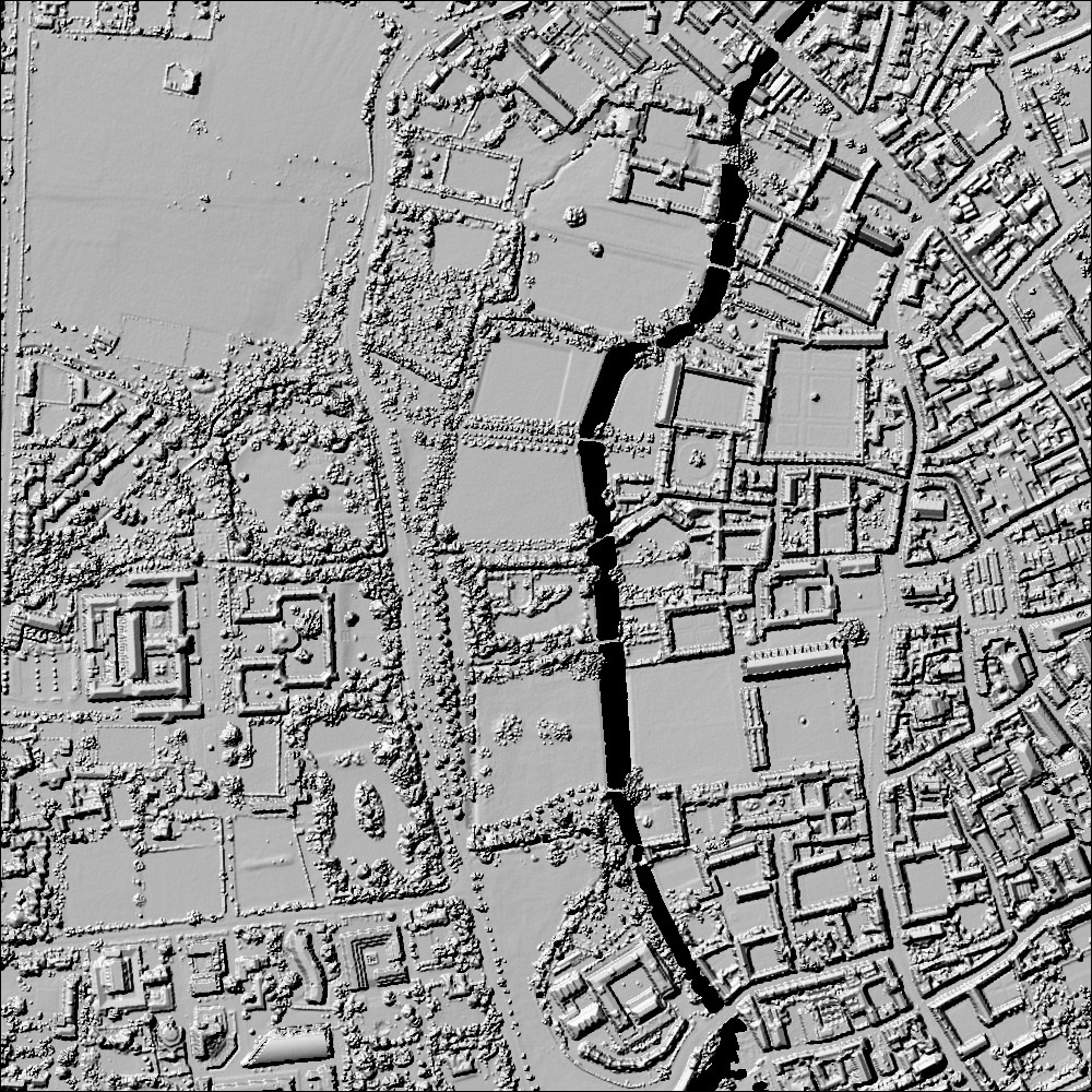
Lidar (which stands for Light Detection And Ranging) is a laser remote-sensing system linked to GPS which makes it possible to trace out the topography of an area, even when covered by thick vegetation. Data is saved during a fly-over of the zone, then processed digitally to perform a "virtual deforestation", thereby skillfully revealing structures on the ground. The picture on the right of the Cambridge area in England, is a typical example of a high-definition image (1m definition) obtained using this technology.
The Franco-Guatemalan project Naachtun has benefited from the use of Lidar technology by covering 140km2 of jungle near the eponymous site in the north of Guatemala. This recent technology, which is much more effective than aerial or satellite cartography, has revealed previously unknown Mayan buildings: pyramids, palaces, ceremonial venues, but also simple houses and cultivated land. In total more than 12,000 structures have been discovered in this region alone. Even Philippe Nondedeo, who is directing this project, had not imagined the area could have been so densely populated.
Lidar is mostly used in the Peten Basin, an area rich in Mayan sites including the famous city of Tikal. It has revealed new urban centres, complex irrigation works and tens of thousands of buildings. Most importantly it has brought to light the existence of a hitherto unknown network of inter-connections between several Mayan cities.
Dominique Michelet, a Director of Research at CNRS in France, involved in the Naachtun project, has underlined, however, that time is still needed to correctly interpret the findings because the area covered has been superimposed with vestiges of 1,500 years of human presence. So it is not yet a question of making reliable demographic estimates from these figures, and even less coming to conclusions regarding how these societies functioned.....
source in french: Bernadette Arnaud, « Une constellation de vestiges Mayas inconnus repérés au Guatemala », Sciences et Avenir du 5 Février 2018 (consulté en ligne en Avril 2018)


